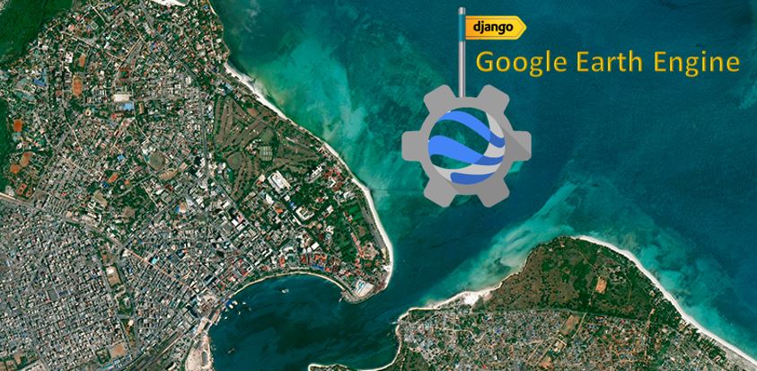
Interactive web mapping with Django and Google Earth Engine
Published on Jan 10, 2025 | Bikesh Bade | 84 views
There are several ways to use GEE and each one has its advantages and disadvantages. In this example, GEE is used for web mapping with Python Django.
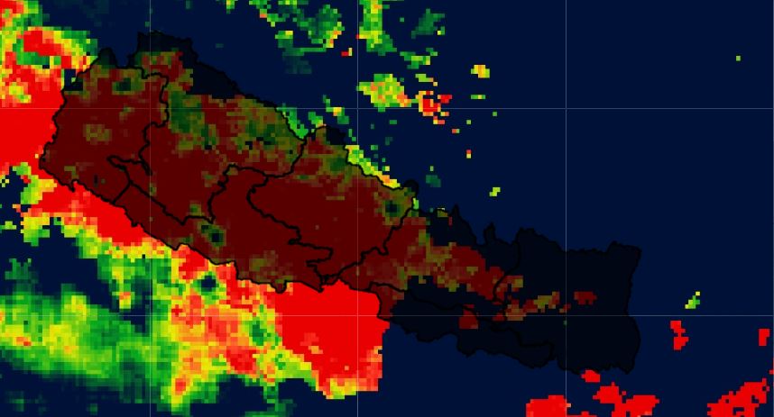
Chirps Precipitation to Excel - GEE and Pandas
Published on Jan 01, 2025 | Bikesh Bade | 42 views
Extract Climate Hazards Group InfraRed Precipitation with Station data (CHIRPS) is a 30+ year quasi-global rainfall dataset using Google Earth engine API and convert it into. Excel and charts using Python Pandas data frame.
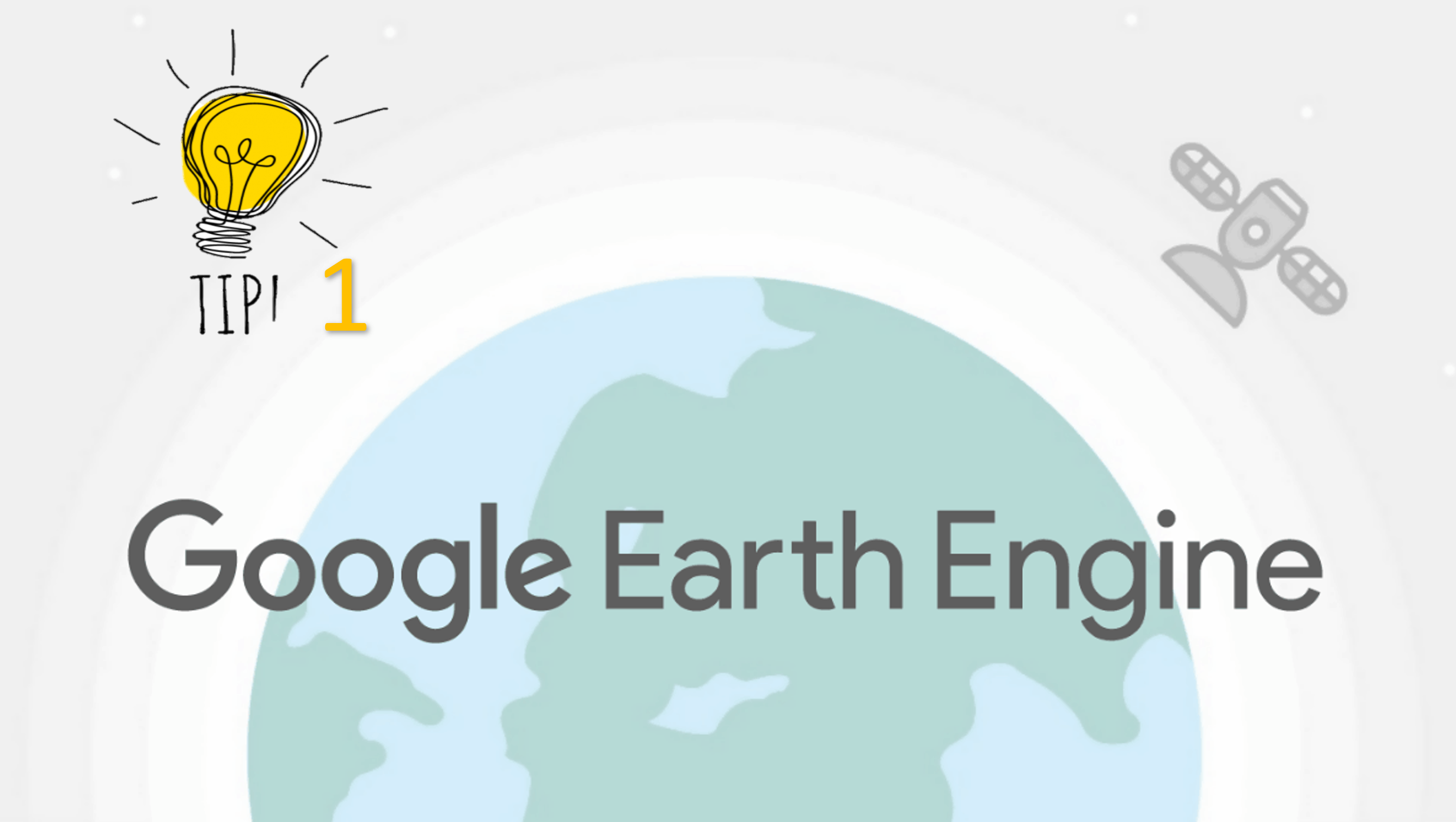
Google Earth Engine tip 1 (clipping)
Published on Jan 01, 2025 | Bikesh Bade | 40 views
Google Earth Engine (GEE) Tips provide a foundation to quickly begin learning and using GEE. If you are new to GEE, you will want to know small and handy tips.
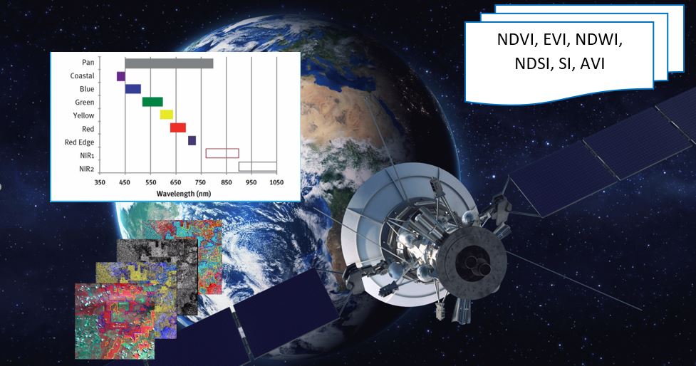
Most used spectral Indices with free satellite data
Published on Jan 01, 2025 | Bikesh Bade | 38 views
Today many different indices exist and each one has its own significance in the study. Here are the most popular indices that be calculated from free data satellites.
Integrate Google Earth Engine(GEE), Pandas framework and Matplotlip - Spatial Data Mining
Published on Jan 01, 2025 | Bikesh Bade | 40 views
Discovery Patterns in Spatial data, extract potentially useful information from data stored in images, and visualize the result in dynamic charts.

Beginner guide to python Folium module to integrate google earth engine
Published on Jan 01, 2025 | Bikesh Bade | 36 views
Folium makes it easy to visualize data that’s been manipulated in Python on an interactive leaflet map.

Export Google Earth Engine Images directly to your computer.
Published on Jan 01, 2025 | Bikesh Bade | 35 views
Export images, image collection, and map tiles from the Google Earth Engine collection directly to your computer.
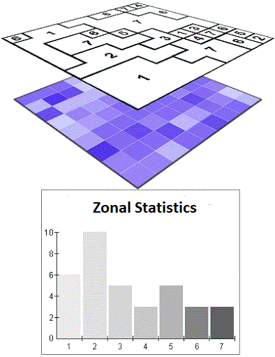
GEE Zonal Statistics and export as CSV
Published on Jan 01, 2025 | Bikesh Bade | 33 views
Get statistics in each zone of the image or image collection in the Google Earth engine and export the data in CSV. Statistics are simple tools that help us for a better understanding of our images. Spatial statistics is one of the most rapidly growing areas of statistics.
Extract hourly Copernicus Climate data - Python API
Published on Jan 01, 2025 | Bikesh Bade | 71 views
Copernicus is the European Union's Earth Observation Programme, looking at our planet and its environment.
Google Earth Engine: Disadvantages and Limitation
Published on Jan 01, 2025 | Bikesh Bade | 90 views
As Google Earth Engine becomes popular in geoscience and data computation, there are a few things to consider before you dive in. This blog will highlight some of GEE's limitations and disadvantages. Importantly, Google Earth Engine is free only for non-commercial, non-production use. This means its sole purpose is to serve educational professionals, students, and nonprofit organizations.
Beginner guide to python Folium module to integrate google earth engine
Published on Dec 29, 2024 | Bikesh Bade | 104 views
Folium makes it easy to visualize data that’s been manipulated in Python on an interactive leaflet map.

SATELLITE IMAGERY - Link to asses free satellite imagery
Published on Dec 29, 2024 | Bikesh Bade | 35 views
FREE SATELLITE IMAGERY SOURCE LINK
Awesome facts about Satellites
Published on Dec 29, 2024 | Bikesh Bade | 62 views
Sputnik 1 was the first satellite in space. The Soviet Union launched it in 1957.
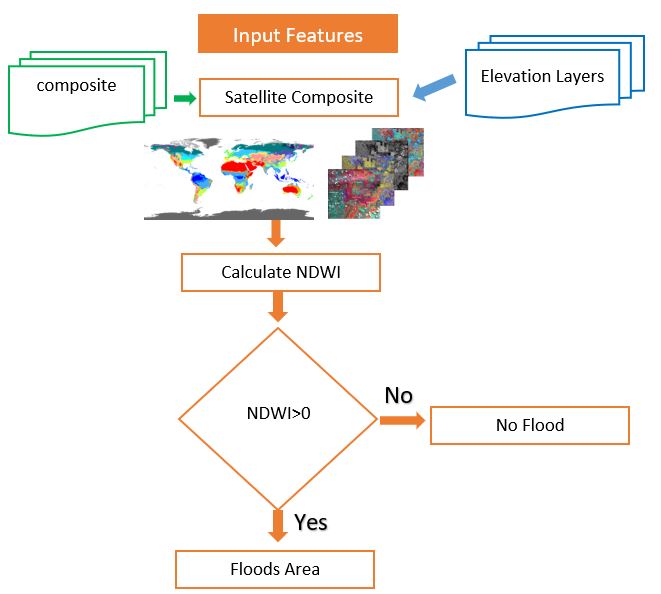
All you need to know about NDWI: Normalized Difference Water Index
Published on Dec 29, 2024 | Bikesh Bade | 49 views
The Normalized Difference Water Index (NDWI) is remote sensing-derived index estimating the leaf water content at the canopy level.
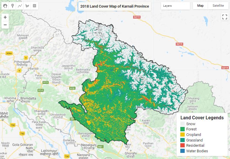
Land Cover Mapping
Published on Dec 29, 2024 | Bikesh Bade | 40 views
The surface of the Earth is continuously changing at many levels; local, regional, national, and global scales. Changes in land use and land cover are pervasive, rapid, and can have significant impacts on people, the economy, and the environment.
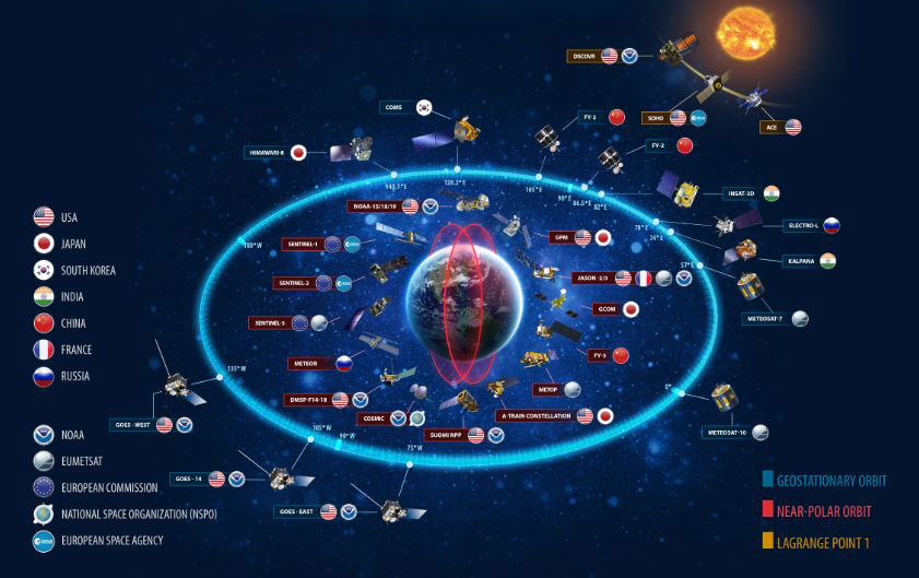
Live satellite Position | Explore the sky roads
Exploring Earth from Above: Where Satellites Meet Geography

Rowdy Panda
Published on Jan 01, 2025 | Bikesh Bade | 93 views
We are living in the golden generation of human civilization Yet, when it comes to friendship, there are no clear rules or straight road. Friendship is always a dilemma and full of tricks and advice also differs from person to person. Connections and friends are an important part of living a happy and fulfilled life. This is the story of friendship and craziness.
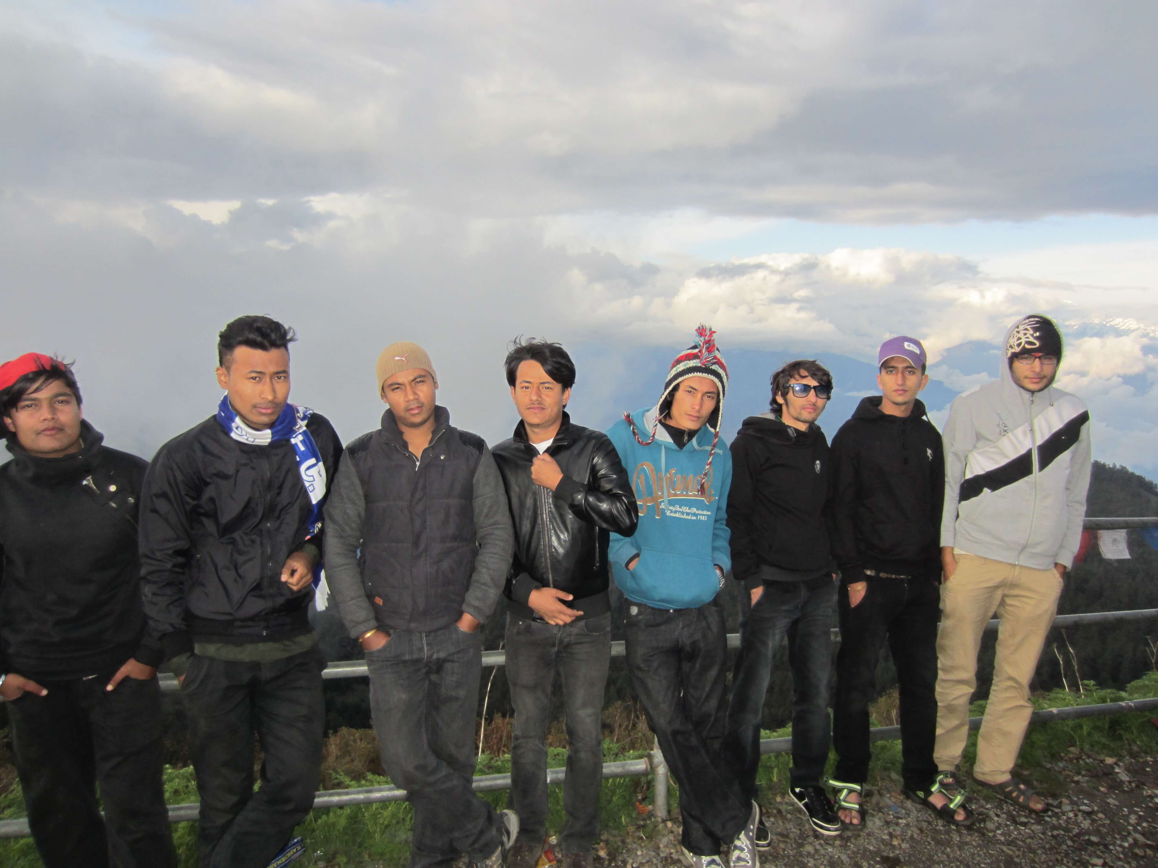
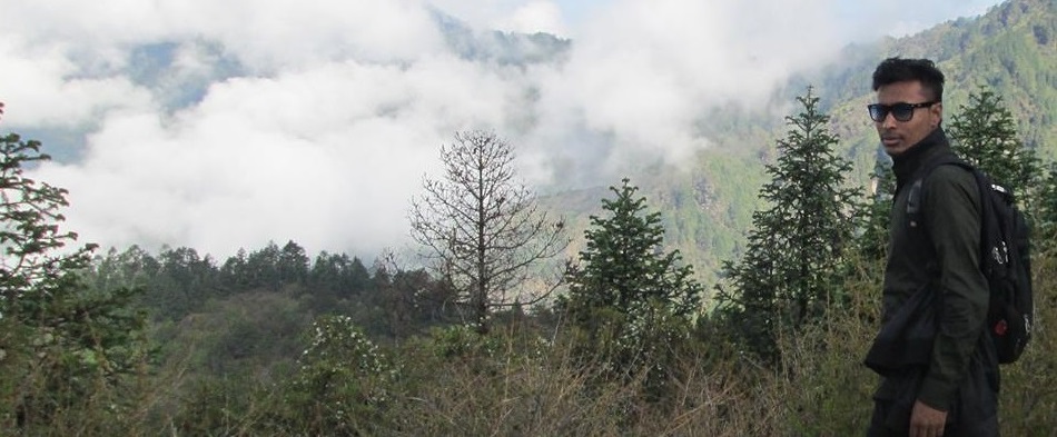
Journey to Kalinchowk
Published on Dec 29, 2024 | Bikesh Bade | 137 views
Kalinchowk is a perfect destination for a short trek. Fresh Air and Mountain views make hiking to the Kalinchowk like traveling to heaven.

Moving to the United Arab Emirates
Published on Dec 29, 2024 | Bikesh Bade | 58 views
Every journey has its own story, my journey to UAE begins with dreams and fear.
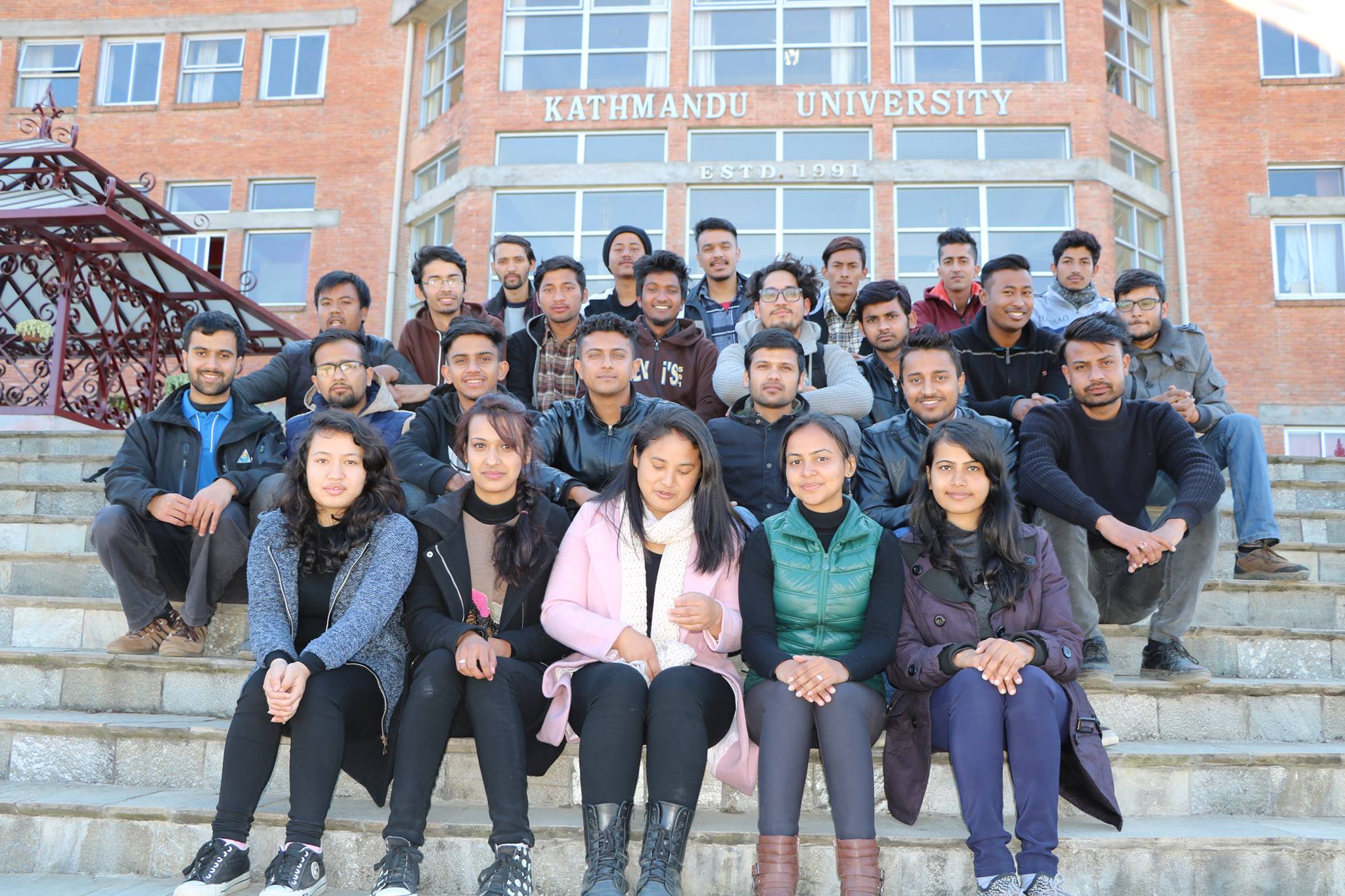
Geomatics Batch 2013
Published on Dec 29, 2024 | Bikesh Bade | 26 views
Dozens of family names, blend into a perfect GE assortment,

Let all emotion get release
Published on Dec 29, 2024 | Bikesh Bade | 502 views
Lost in the space of silence With a depressed heart, Lonely and empty,

Is rain Saint or Sinner?
Published on Dec 29, 2024 | Bikesh Bade | 17 views
Would you call me a saint of the sinner? I float in the sky and dance with the wind.

Friendship between a cow and pole
Published on Dec 29, 2024 | Bikesh Bade | 495 views
It's proven that friendship is not made it happens with time. Who can define the bond between cow and pole?