Beginner guide to python Folium module to integrate google earth engine
Published on Jan 01, 2025 | Bikesh Bade | 36 views
Folium makes it easy to visualize data that’s been manipulated in Python on an interactive leaflet map.

SATELLITE IMAGERY - Link to asses free satellite imagery
Published on Dec 29, 2024 | Bikesh Bade | 36 views
FREE SATELLITE IMAGERY SOURCE LINK

Export Google Earth Engine Images directly to your computer.
Published on Jan 01, 2025 | Bikesh Bade | 35 views
Export images, image collection, and map tiles from the Google Earth Engine collection directly to your computer.
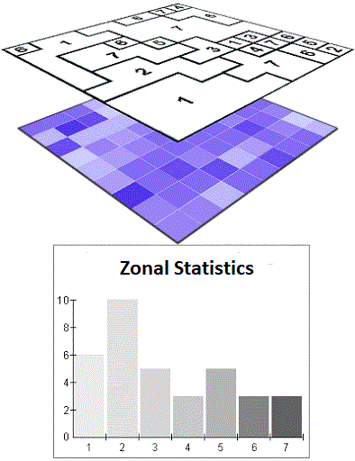
GEE Zonal Statistics and export as CSV
Published on Jan 01, 2025 | Bikesh Bade | 33 views
Get statistics in each zone of the image or image collection in the Google Earth engine and export the data in CSV. Statistics are simple tools that help us for a better understanding of our images. Spatial statistics is one of the most rapidly growing areas of statistics.